Loading...
Home > Printed Aerial Maps > Wisconsin Maps > T > Taylor, WI Wisconsin Aerial Photography Map 2020

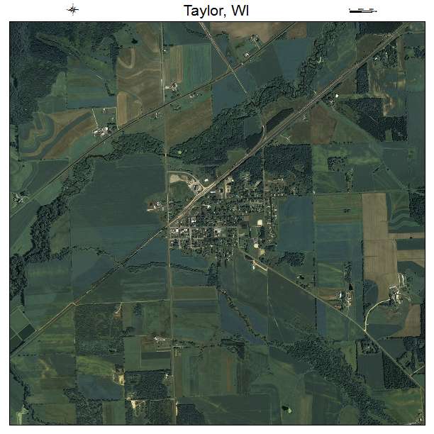
Taylor, WI Wisconsin Aerial Photography Map 2020

CODE: APM-5579150


Price: $19.97

Taylor, WI air photo map
Choice of 18, 24, or 36 inch printed map
2020 aerial photography


Taylor, Wisconsin aerial imagery detail
Detail at 1:1 from center of map
Displays approximate resolution of Map


Taylor, WI location map
Please confirm the extent meets your needs.
If not, contact us at sales@landsat.com or call 928-853-6773


Aerial Photo Map of Taylor, WI

  • 2020 aerial photography taken spring/summer.
  • Printed with archival inks. 100 year life with proper storage.
  • The map includes a title, north arrow, and scale bar.
  • 3 sizes to choose from. 18, 24, or 36 inch.
  • Rolled and shipped USPS Priority tube.
  • We put your small town on the map!

    Want a custom area Aerial Photography Map, we have imagery for the entire USA.


    Interested in a Street Map of the same area?
    Taylor, WI Street Map


    Interested in digital Aerial Photography so you can make/print your own map?
    Jackson County, WI Aerial Photography CD


    Interested in USGS Topographic Maps also?
    Jackson County, WI USGS Topo Map CD

    Taylor, WI Wisconsin Aerial Photography Map 2020
    2020 Aerial Photography Map of Taylor WI Wisconsin
    Image Trader
    Product ID: APM-5579150
    $19.97 New In Stock