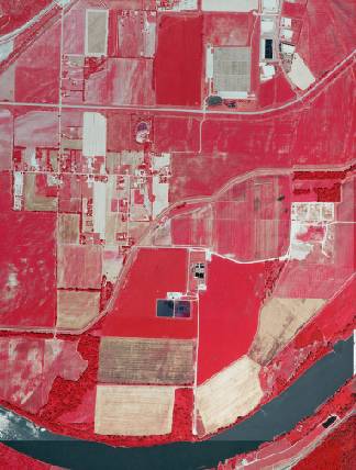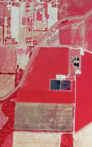

Midwest, USA aerial photo sample

Midwest, USA aerial imagery zoomed in! This shows the level of detail you will get for Kansas
See samples from other locations: Airport Airport zoomed in Stadium Stadium 2 School Waste Water Treatment Plant Treed Area & Farmland
2008 Statewide Aerial Photography of Kansas Product Information
Info for the GIS professional:
**Not for novice users. Professional GIS use only**
2008 Statewide Aerial Photography for Kansas 1M 4 band Color/CIR (professional use only - ArcMap compatible)
https://www.landsat.com/Kansas-Statewide-aerial-photography-1cir2008.html
Statewide Aerial Photography for Kansas 2008 1M 4 band Color/CIR (professional use only - ArcMap compatible)
Image Trader
Product ID: KS-1cir2008
$299.00 New In Stock
